Showing posts with label Royal National Park. Show all posts

Tuesday 10 January 2023

Karloo Pools and Bottle Forest Trail

Christmas came and went, and the New Year was approaching, I hit up my friend Tristan to come to the movies to see the new Avatar film 'The Way of Water'. While catching up after the film we got to talking about another walk and Tristan threw out the idea of Karloo Pools on the 2nd day of the New Year, the day before I returned to work. I said that it sounded good to me, who had spent most of the Christmas break laying around inside eating really heavy meals.

So, the day before I quickly messaged another friend Biris to see if he would be joining us, unfortunately he was busy with a barbeque. Tristan offered to pick me up and decided to bring his girlfriend who was mentioned in my 'Kiama Coastal blog post'. My first time actually meeting her.

He arrived outside my house, and we set off towards Waterfall. Chatting along the way. As we arrived at Waterfall train station Tristan decided he needed to poo, with me jokingly telling him he should just go in the bush. As we began walking to the station looking for a toilet, he realised that the walk began at Heathcote train station, so we got back into his car and he stopped at a service station along the way to use the loo.

As we arrived his girlfriend Amy and I both felt we needed the toilet and went at the station. We then followed Tristan's lead over the track to the other side looking for where the walk began seeing a few people heading that way. We followed them and found the entrance to the walk.


As we inspected the map, I mentioned we could have walked there from the Uloola Falls walk at Waterfall station (a walk I have done a few times and have meant to return and do again as a blog). He commented that we could have, but this way was shorter. My eyes bounced around looking at all the different walking trails wanting to do them all. We then began the walk in the sweltering heat wondering how I would go after my diet of rich Christmas food.

I could tell instantly that the walk was a popular one, there were people heading towards the entrance as we began the walk and various groups ahead of us.


As we followed the path along the back of the houses Tristan's girlfriend Amy mentioned that it would probably be nice to live on one of these houses, however I said I wouldn't like to as there is not enough privacy for my liking, especially with the amount of people traversing the trail.


To our right we came upon this structured sign, and I thought above the generic 'New Years Resolutions' but couldn't be bothered coming up with any because I never live up to them.

The path soon forked, with us following the trail right into the bush, towards Karloo (while the trail to the left was an APZ trail).


Tristan pointed out particular plants along the way, using his bush regeneration knowledge. He also pointed out an Eagle, which to stir him up I kept insisting was a bird it wasn't (such as a pelican).

Along the thin trail we weren't walking particularly slow, overtaking some people whilst also stepping aside to let groups of other people march on ahead of us.


We stopped along a rocky slope looking at the scenery. The discussion soon turned to travel with Amy mentioning swimming in the Nile while on a trip to Egypt, and I mentioned my upcoming trip to Iceland, she asked me about the Midnight Sun, and I said I thought that it occurred there, but wouldn't at the time of the year that I would be there.

The walk began to slightly incline, and we continued along the uneven surface (though it was not treacherous and was a very easy walk still).


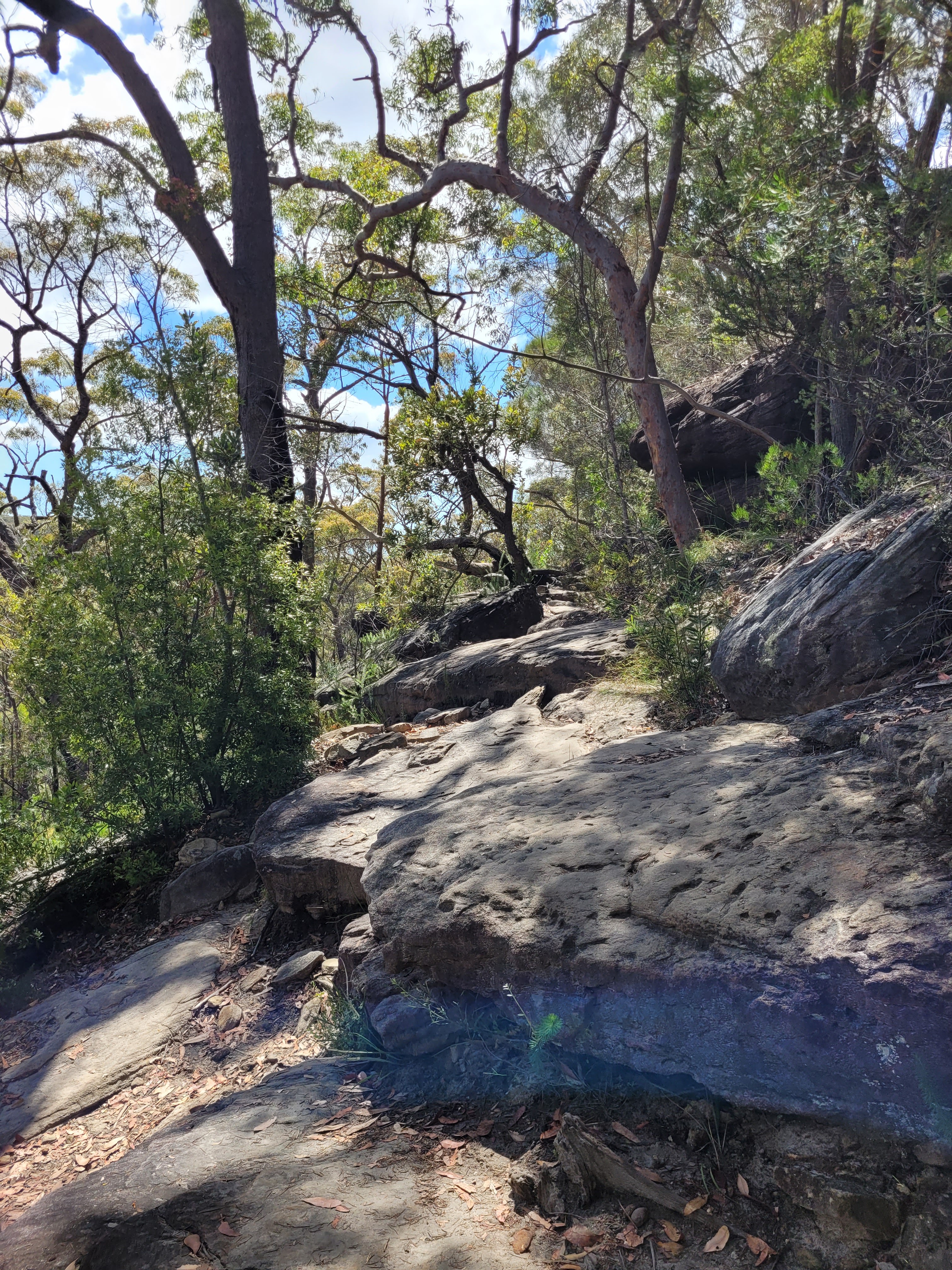
After reaching the top just over the incline in the picture above the walk began on the same uneven surface but on a much sharper incline downwards that at some spots on the walk involved a little bit of scrambling just to avoid the people who were working their way back up (many of whom were stopping due to exhaustion and the heat as they worked their way uphill). It felt like we spent longer heading down then we had on the rest of the walk and wondered if we would look like these poor souls on our way back.

We soon arrived at Karloo Pools, which I could hear before I saw it. As the pools came into my sights, I realised why I had heard them, it was like going to a public swimming pool with the amount of people. We looked from side to side along the watering hole and opted to go to our left and climb up on a big rock away from people overlooking the water. I debated whether or not to get a photo as so many people where in there but opted to quickly take one while looking at my phone so it was 'inconspicuous'.


As I sat up on the rock observing the people around me, not far from my right a group of young teenagers lounged about, blasting their crappy music for everyone to hear. "This isn't a fucking water park" I thought angrily. "Nobody wants to hear your fucking shit."

Just down beneath me two young teenage boys threw stones into the water heading down stream and were told of by a lady who said he and her friend were trying to go in and swim there. The boys completely ignored them and continued just throwing rocks and while the woman looked at them with an incredulous look, unable to believe their sheer rudeness. 

"Are you coming in?" Tristan asked me. I told him I wouldn't as I didn't bring any swimmers and I didn't fancy walking in wet cloths, and that there were far too many people for my liking. Him and Amy went in for a swim and I sat trying to tune out the music and image the area without people.

While the two of them were swimming I noticed a particular couple come down, they came around to the side I was one before turning around and going to the opposite side to read a signpost before continuing along the walk. They didn't look like they were here for a swim and I figured they were continuing along the walk to either Uloola or Audley. Once Tristan and Amy returned and got changed, I asked if they wanted to continue the walk. They said they were ready and we walked around to the signpost I had seen the couple read. The sign seemed to imply that if the followed it inward to the right it would take you to Uloola, but if you continued straight ahead it would take you on a loop track up Bottle Forest Trail and back to the entry. They agreed that they wanted to do the loop and we headed down that trail seeing a few Water Dragons and at one point a Goanna.


As we continued along Tristan continued to cast doubt that we were even following a trail. I insisted we were saying I was 90% positive. Each time we got to a section that was slightly overgrown or the trail seemed a bit harder to find, Tristan would turn to Amy and asked if she trusted following my lead. I would then again insist I was positive but lowering the percentage to maybe 60% before again finding an obvious point in the trail and raising my percentage level of assuredness. 

Tristan continued to remain skeptical that the path looped, bit I said it had been on the map of the signpost that I had forgotten to photograph (having felt like some of my previous blog were too photo heavy I actively tried to not take as many photos during the walk and instead just enjoy myself).

At one point Tristan even stopped to try and GPS were we were, insisting the trail wasn't a loop but was a retention basin on the map, and when his GPS loaded up it did indeed not show any looping trail (it did show the Bottle Forest Trail, but not connecting to the track we were on).


Obligatory selfie

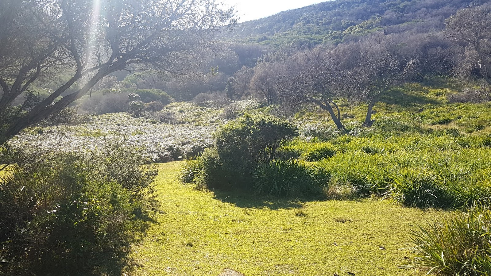
As we continued down some of the water spots were very clear and looked wild and like much better spots to swim in (with a distinct lack of crowds), however both Amy and myself commented at different times that the reads made it look (for some reason to us) like the water would contain Crocodiles (though we both knew they didn't).


I was happy we had come down this way, given how beautiful the views were (much more than any parts on the previous sections of the walk), but Tristan had me beginning to doubt myself and I was soon convinced that, as he said this walk simply continued through to Audley. I told them both we would get to a certain bend in the river (that I could see we had not yet reached when looking at Google Maps) and said if we did not come across a turn off to our left by that point, we would simply turn back the way we came (as I remembered from the signpost map whereabouts the loop trail was meant to be.).

As we continued further down the trail the silence was broken by voices in the distance and I suggested that we would ask the people about the 'Bottle Brush Trail' and Tristan, and I kept misremembering the name (even commenting on the lack of Bottle Brush Trees along the walk).

As we rounded a bend there was a group using a rope swim and some people swimming in the river. I called out and asked if they knew where the 'Bottle Brush Trail' was. The lady in the water replied that she found that funny as there were no bottle brush along the walk (she must have misread it too, that or the signpost I didn't photograph was incorrectly labelled).

She said something about it being 'Olympic Pools' though I could find no reference to that name on Google Maps looking along Kangaroo Creek (the creek we were following) and the only reference to that name I could find was doing a Google Search where it came up on the app: AllTrails.


As we walked, Tristan and I referenced several previous walks and he joked that soon all my blogs would simply be talking about old blogs. I told him that I had already found some of the previous ones too referential and that I would be looking to try and remove that so much from future posts. Amy commented that she was surprised we remembered enough to write about everything. I thought about that in my head afterwards, noticing how much I had struggled with my conversational recall while writing previous posts ever since having my chemotherapy, and even while trying to start this post messaging Tristan to see what he remembered, which wasn't much, which at least made me feel like it wasn't so much the chemo-brain, but the amount of conversations and distance in time between doing a walk and writing about it.

Tristan suggested the idea of bush-bashing through if we didn't find the trail and suggesting if we headed the right way, we might link up with the Bottle Forest Trail. I threw that idea out, saying I'm fine with bush bashing but the bushland was far too thick and heading uphill, I said I was happy enough to walk down a bit further and if we didn't find it, we could simply head back and walk up the way we had come.

As Tristan continued ahead along the trail while I stopped to take photos, I heard Amy call out that there was an arrow and as I caught up to her, I also noticed the cairn at the base. Tristan had to come back as he had walked ahead without noticing it and Amy seemed pretty happy to have found the path on the walk, with me sharing a gloating smile at Tristan.


As soon as we began up the stairs Tristan began complaining about me making them have to walk uphill. 

"It would have been uphill on the way back anyway." I told him, "At least we got to get to explore a different path." He continued to whinge but because it's Tristan I assume he was whinging for the sake of it and was not literal with his complaints.


The walk up was pretty steep, but more evenly footed than I felt the way returning from Karloo Pools would have been. We stopped once along the way for the two of them to catch their breath and I commented to Tristan he seemed out of shape compared to when we had done the Kiama Coastal walk together.

"Are you calling me fat!?" He jokingly said angrily to me.
"No, I just mean your fitness. It's reminding me of when we did Mount Jellore and you got cranky at me for wanting to let you stop once we got to the top."


We reached the top of this section and we stopped again for a breath and some water, behind us the couple I had seen wandering around at Karloo Pools appeared (they had been that the spot the lady had said were the Olympic Pools, but we had not spoken to them there).

Tristan said high to them and started asking them a bunch of stuff and the woman needed him to speak slower and I realised that they were foreign and didn't speak English super well (the accent sounded slightly German but I couldn't say for sure). She mentioned they had seen a monitor lizard along the way (the Goanna we saw), and they continued on.


The walk continued up and Tristan continued to complain, however I was surprised by my own fitness but then realised the Christmas break hadn't really been that long, so my fitness wouldn't drop off too much no matter how much Christmas ham I ate.

Soon we heard another group catching up behind us and we stopped to let them pass while Tristan laid down for a rest.


 As the group walked by one of the men looked at Tristan and back at me, nodding towards Tristan he said "Living the life."

Soon they passed and I told Tristan I was going to nickname him 'Old Man Banksia' as he had commented that there had been a lot of them along the walk and not 'bottlebrush trees' as we had thought. I also commented to Amy that there's probably more pictures of Tristan on my blog then there are of me.

We soon reached a dirt road opening with a signpost I thought would say from the opposite direction where the walk was heading, however it didn't (I can't actually remember what it said, which is why while walking I usually take way more photos then ever get uploaded just to help me remember things sometimes).


As we continued on Amy mentioned she wanted to get a 'Storm' (a type of Sundae) from Hungry Jacks after we finished, I agreed to the idea of Hungry Jacks, having recounted to them my story of learning to like pickles from my trip to Finland while we had all been talking about travel along the walk.

"An Orchid!" Tristan said, pointing it out and saying it's scientific name only for me to instantly forget it.


"I've got a bone to pick with you." Tristan said to me as we continued.
I looked at him.
"You're the most negative guy in positive situations and the most positive guy in negative situations."
I thought about that for a second.
"Thanks" I said to him, taking it as a compliment, further frustrating him.


The walk soon came out along the APZ trail we had seen from when we initially began the walk with a signpost on each side, left pointing to Heathcote and right pointing towards Audley.

"So that's how you get to Audley." I said, wondering if Amy had not seen the turn off and we had continued the way Tristan was heading where the path would have led.

We were soon behind people homes again as we followed the APZ.


As we reached the end of the walk, I thought about my return to work the following day and looked forward to taking some time off once the holiday period had ended for some more walks.


If you have enjoyed this post, or my blog in general, please follow it, or like my page on facebook or follow me on Instagram
Thanks for reading! - Steven

Thursday 27 June 2019

The Coast Track - Otford to Bundeena

November 2018

For my birthday in 2018, my Wife wanted to do something for me she knew I would like, which is hiking. So she took me up to Bundeena for a walk for see the Wedding Cake Rock, not intending to do the entire track (Bundeena to Otford) though she knew I at one point would do the entire walk she believed she would not be able to, but wanted to at least experience seeing Wedding Cake Rock with me for the first time.
While driving there through the Royal National Park (a long winding road) I realised there was so much potential here, noticing numerous walks off the road we were driving along realising I hadn't done any of them and planning to get around to doing many more.
We arrived at Bundeena, and began our walk along the track. It was quite busy in certain sections but generally we were alone as we walked along the trail.

Towards the start of the walk I noticed a track off to our left to Jibbon Head, where while learning to drive on my L Plates with my Dad, he had taken me to Bundeena and we had walked over to Jibbon Head (although a different way), to see the Aboriginal Rock Carvings. I remember being super fascinated, and it took me back to my youthful years in Primary School while in Year 3 we learned about the discovery of Australia (by Europeans), and I loved learning all about Dirk Hartog and the Pewter Plate (I even got to make my own one (out of paper) in school. So going there had made me feel like a kid when I used to play and pretend to be an explorer or adventurer. I commented to my Wife that I would like to take her out to see it on our way back as we continued along the path.

As we turned around the corner we were greeted by the site of an Echidna crossing the path.


It was a good start to the day. The weather was nice and we found the trail reasonably enjoyable enjoying the gorgeous flora and ocean views.


The walk was reasonably flat, until you made it to the ocean, from here it was a little up and down, although there was a built path you could walk along, which although I'm not usually a fan it made for a nice change of pace and made the walk comfortable.

I was blown away by the sheer amount of people along this point. So many different people taking selfies and getting photographs of themselves, but it was more than that. It was like hordes of people taking model shots with giant cameras. Shirtless men doing handstands and jumping, and flexing and posing, and women surrounded by friends dressed up taking millions of photos modeling for each shot and coming back to check their photos.
My Wife asked if I would like a photo and I refused. I have no problem taking a selfie, everyone likes a good photo, it's something to make you feel nice, say hey I was here, remember that moment. But this was too much for me and I just wanted to keep walking and get away from all of it.

The path began to go a bit more up and down at one point walking down the side of a cliff (with stairs built) across a little bridge and up again, continuing up stairs built into the dirt.
We eventually arrived at Wedding Cake Rock, surprised at how short a walk it had felt.
The segment of cliff face was now surrounded by a big fence, warning people to stay off it (due to numerous Instagram selfies) as the rock was unstable and could at any point break off into the ocean. Now as I said I don't mind a good photo, but if you're stupid enough to risk your life just for a photo then you're taking a photo for the wrong fucking reason.


Look at that fucking giant crack

Of course plenty of people where coming up and looking around hoping to be left alone and quickly jump the fence to get their picture. We shook our heads and commented about natural selection.

We continued past Wedding Cake Rock, and by this point there was almost no one on the tracks. They were here for that. We walked to Marley Beach, and I commented that we should probably head back and walk to Jibbon Head to see the carvings before we were to head off for the rest of my birthday (with my Wife planning to take me to Milky Lane in Bondi, because I had never been).


When we arrived back at the track to Jibbon head my Wife was distraught to find it was along sand (she hates sand). Not only was it a slow walk trying to trudge through the sand it was a long walk too, and finding our path once we made it to some bush-land was a little difficult too, with no clear signs, and a couple paths that looked like bush regeneration work was occurring. We finally found the path and we stopped at a section with seats and a couple aboriginal mythology and history signs while my Wife tried to work out if we would be able to make it in time to Milky Lane (as we had to walk back, drive to a train station and get there and a table had to be reserved).


This particular sign told the Aboriginal Myth about Windang Island. Which, ironically, I had planned to do the rest of the Coastal Track one day, but it was a cliff fall on Windang Island that would actually stop my Dad from doing the walk with me.

We made it to the carvings and since I had last been there and big stand had been built that you could now walk up to get a better view of the carvings. I attempted to take a photo but with the quality of my phone it wasn't doing them justice. We began the walk back as dark clouds came over and my Wife began to get annoyed with me, believing we now wouldn't make it to Milky Lane in time which she had planned for my birthday.
To make matters worse it soon began to rain. So we continued trudging through the wet sand, continuing uphill. It felt longer than the rest of the day had felt and my Wife wasn't speaking to me. We made it back to the dirt path and I told her I thought we'd be able to make it in time.


We made it back to the car, wear we quickly got changed into the spare clothes we'd packed to go out in and began driving through the Royal National Park to Waterfall train station, getting stuck behind someone doing 20km under the speed limit. We eventually made it and got a train to Bondi, and a bus out to the beach and made it to Milky Lane for dinner where I got the 'Carolina Reaper Chicken' that I had to sign a waiver to eat. I smashed it down as people from other tables looked on. One man asking the guy who served it to me if it was a 'challenge' he said they didn't like to call it that because it made more people try to eat it. It was spicy but I didn't think it was something that needed a waiver. I enjoyed a 3 or 4 various over the top delicious cocktails and we made our way home.

June 2019

I had been busy with work and I decided I needed some time off to do something I loved. I booked in two flex days and told my Wife and Dad that I was going to do The Coast Track. As soon as I told my Dad he jumped at the opportunity, saying he would be alright to come and was looking forward to it. Not even a few days later he contacted me saying he just wouldn't be able to, and that even though he had been walking and bike riding to train he was just in too much pain from his fall still to be able to do such a big walk. I was back to doing it alone. My Wife began looking into it, asking if I believed if she could do it to. I agreed that she could but it would be a long hard walk. She bought some hiking boots from Rivers and took a day off from work and we planned to do it Friday the 1st of June. We had planned to go from Bundeena down to Otford, but my Dad looking into it for us told us we should begin at Otford, as he believed going that way would be easier for my Wife as you would begin heading downhill, instead of after a long day hiking ending by coming uphill. We organised an early start where we would pick my Dad up in the morning on the way, stop at Otford, he would drive the car to the end at Bundeena, leaving the car there (we would have a spare car key) and he would get a ferry across and take a train home, leaving the car there for us to finish our hike and head straight home.

We had our food ready the night before and set our alarm for 5:30 in the morning to give us enough time. We woke up in the freezing cold for breakfast, I debated whether wearing cargo pants for the hike before deciding I would endure shorts as we set of knowing I would warm up along the way and we set off to collect my Dad, listening to White Buffalo as we drove.
I hadn't even looked in to getting to Otford. I posed the question while I drove asking which way was better to get there, whether to drive up Mount Ousley and turning off at the Stanwell Park exit or to go along the coast through Austinmer, saying that the traffic travels faster up Ousley and you're not stopping at lights. My Dad said that is the way he would go, and we followed it up, soon arriving at our destination of Otford lookout. I took my jumper off, throwing it into the back of the car knowing I would be annoyed caring it the whole way. I thanked my Dad for dropping us off and he drove away off to Bundeena to drop the car at the end for us.
Two old ladies wearing hiking gear (talking much too loudly), commented on me wearing shorts and a T-Shirt.


We began the walk that started straight up to the lookout, with a beautiful morning view over the ocean.


We enjoyed the view shortly before setting off following the fence along.

My Wife walking

The flat dirt path didn't last long, turning instead into a uneven rocky path we followed shortly uphill before encountering the turn off down to Werrong Beach, or as it's just known locally 'The Nude Beach'.


The path continued up further, (with my Wife commenting about how starting this way was meant to be 'less' uphill), before flattening out again, all the while passing through beautiful changing bushland.


We followed a small dirt path through that eventually widened we walked along here for a while before coming to our second split in the track.


The scenery changed again through here, as we headed towards the coast. The dirt path became sandier and we passed many flowering plants.


From here we finally started to begin downhill, coming to opening looking out over the ocean every now and again.


As we progressed down the track became darker and muddier and more like a rainforest.


We made our way down numerous stairs where I commented to my Wife that she would have had to walk up these towards the end. The path flattened out now and again still continuing down while the scenery began to become more tropical with noticeably more palms.


We were making good time and I felt happy being able to get out into it, pointing out a cool tree stump and not missing the opportunity to play around.


After a lot of walking the trail started to be nothing but Cabbage Tree Palms.


Passing through here I commented that this looked like a nest made by Gorillas


I wondered out loud if this was burning palms, reasoning that because all the palms were dying and dropping of with that orange tinge in the sun they could be called 'Burning Palms'. We soon past more ocean and coastal views before the path began to head up hill again, still going through the forest of palms.


We eventually made it to an opening in the forest with a sign telling us we were in the 'Palm Jungle' and not Burning Palms.


We stopped here for a little snack to perk ourselves up as well as to apply sunscreen. I swapped my beanie over for my cap, putting on a pair of sunglasses we followed that path out into a beautiful sweeping hills and I commented to my Wife that it felt like we were in Jurassic Park.


We walked over the rolling hills while the waves violently slammed against the cliffs by the shore, in the distance we could see the Royal National Park Coastal Cabin Communities. Although taking photos the way we were heading, (especially from the distance) was fruitless with the sun in our eyes for the entirety of the walk in this direction.


We walked past a couple more flowers as I snapped a photo, quickly realising that they were actually the flower of the noxious weed 'Mother of Millions'.


We continued our way around the headland until the raised platform we had been walking on reverted back to a small dirt path and we arrived at Burning Palms.


There was two paths we could follow, one straight and one heading down to the beach. I quickly ran down to the beach just quickly checking this wasn't the way to follow before we head up through the bush continuing our way on to the Cabin Community.


Cabins in the Distance

Burning Palms Beach


We came along a sign pointing the way to the famed 'Figure 8 Pools' right by a little bridge leading right into the first section of the cabin community, and while it was something we did want to see, it was high tide and the waves were very heavy, so we decided that we would simply come back and do the trip just to this point and back to Otford on another day to see the rock pool.


It was a surreal experience, the place was completely empty and there wasn't a soul around (unless they were all asleep), but it felt like walking through a place abandoned by time, post apocalyptic almost, even though I knew people lived in them and you could see many with satellite dishes and solar panels. We continued through the little village heading down and back up again, where the path soon turned to a sand one.


Before we reached a section of steps I pointed to my left to one of the cabins out to my Wife, it was painted stripy, with a sign in the window saying 'Hansel and Gretel's'.

We continued up the steps as the sand turned to dirt, passing a sign on the way saying about track work. We were surprised when we reached the top and started along another of the built pathways that it stopped dead, dropping off and that there where two men there working on building it. I said good morning and stepped to the side along the edge of the hill walking towards where there was no partially constructed path in my way.
"Honey!" I heard my Wife call and turned back to realise she was struggling to get along, trying her best not to fall down the hill.
She caught up and I said sorry I didn't realise that she was having any trouble. We made it past where they were working hopping back onto the path reaching a signpost where the path split off left to the Burgh Ridge Track and a guide showing us where we were and how far we had come, as well as providing bits of information.


We continued along this path around the next bend in the coast where the path stopped opening up into  huge field and a little Cabin Community nettled down from us. The sign pointed forward and we couldn't see any clear way to go, so we walked straight up the hill, noticing thousands of rabbit poos all through the grass.

Looking back the way we came from the top of the hill

We soon realised there was no path this way and headed to our right (left from the way we had came) down towards the community when my Wife pointed out a little post asking if that was the way. I had seen it before but assumed it was an out of sight cabins letter box, as we approached it we saw this was not the case, but was the trail offering information and a pamphlet of the North Era settlement.


I took one, saying that my Dad would have loved this and I'd have to lend it to him, my Wife insisted I grab an extra for him so I did.


The path wasn't well marked here and we found ourselves following a trail through the sand, much to our displeasure.


We reached a particularly big step that I hopped down with ease, I turned around to see my Wife looking at me, longing for some help. I came up to the edge and grabbed her around the hips to help her down, as I did and took a step back a root stinking out of the sand caught on my left shoe almost tripping me, I stumbled while holding my Wife, regaining my balance as the root whacked against my right leg causing me to call out in pain.
My Wife questioned what happened as I placed her down, gritting my teeth. I said it wasn't too bad looking at it, it seemed like a little graze.


We followed the path through to where it opened to North Era beach and we began trudging through more sand towards the other side.


We crossed, walking up the hill on the other side, and then down again to another beach we had to walk across.


She loves sand as much as Anakin Skywalker


Crossing this beach we found we had arrived at the North Era Camp Ground, which we had wanted to make it to within the first 3 hours to be on time (from what we had looked up), in order to make it to Bundeena before dark, and we we running ahead of schedule and making good time. We walked up the hill a little before stopping for some morning tea and a little bit of water.


While eating a little Magpie slowly made his way from all the way down on the ground up to a metre away eyeing off my sandwich, I offered out a tiny piece of bread wanting him to take it from my hand. He slowly edged closer and I truly believed he was going to take it, soon another Magpie called and he flew away. I promptly ate the piece of bread insisting to my Wife that we should carry on.

I took a snap of a thistle and the scenery looking south while I waited for my Wife to put some band aids on her feet and adjust her boots.


Walking up these steps my Dad called letting me know the car would be there waiting for us and that he had caught the ferry over to the city, enjoy a coffee at a cafe and was waiting for the train to arrive at the station and take him home. I let me know we were ahead of time, letting my Wife slowly walk on uphill as I talked. He asked how she was, and I said she was doing pretty well and that she had only struggled on uphill sections (and on sand) so far. We hung up the phone and I jogged up the stairs to catch up with my Wife.


We reached the top where there was a little bush land where the trail began to head down but we stopped for our first awkward scenario (not so much for me) but for my Wife needing to 'use the bathroom'. A loud sound burst from around a the corner and an army helicopter flew straight by us. My Wife commented that it was lucky it didn't come a few seconds later and I kept a lookout while she went before going myself and we began making our way down the stairs to what looked like yet another section of the Cabin Community.

After making our way down the winding stairs we walked through the Cabins. I noticed a cabin dedicated to bush regeneration with a little plaque shaped like Australia out the front of it right by the path we walked through. We continued down to Little Garie where I was started by a Ibis like bird squawking loudly flapping it's wings and running past me.


We worked out way down to the beach and along the ground next to the bottom of a cliff face.


My Wife saw this sign and instantly began to power walk through, telling me to keep moving, pointing out a cross and claiming that someone probably had a rock fall on them.


We soon made it past the cliff face, arriving on Garie Beach. I commented to my Wife that it looked familiar before realising I had been here before along with Wattamolla and Bundeena on a driving lesson with my Dad while on my L's many years ago.


I pointed out that there was a toilet here and we both sighed sitting down a little picnic table for a little breather, working out where the half way point of the walk is, deciding it was at Curracurong.

We continued along the beach noticing tracks along them and debating what animal they belonged to.


We came to a nice grassy patch as we walked up from the beach at the base of the hill before beginning another up hill walk.


This continued up pretty high and along an edge where the wind started to pick up and my Wife (who is terrified of heights) began to panic. I calmed her down telling her it was ok and convincing her to continue on up as it would head away from the edge. We passed a cool hollow rock on our way up and I enjoyed a beautiful view along the coast looking back at how far we had already come.


Reaching the top the landscape changed again, and it was like looking out over an endless abyss of leafless dark banksias.


As we wandered on endlessly along the path these banksias were occasionally broken up with Xanthorrhoea (Grass Trees).

This seemed endless, and while I had at first enjoyed the view I soon commented that it was never ending. Then before I knew it we had walked into a section filled with new green growth, it came up so fast that I didn't notice until we were actually in it.


It didn't last long and we were back at looking at an endless horizon of banksia. After what felt like hours of walking (and probably was), we began heading down closer to the cliff face.


Heading down and closer we could feel how strong the wind was, and I could see in the distance the water from a waterfall being blow up and backwards back over the falls. We came down to a little stream with water flowing into the ocean, continuing up past it and on towards the next bigger river.


Before hitting the next river, where I had seen the waterfall in the distance we passed the turn off to the Curra Moors Trail.


I didn't even notice or realise that this headland was the famed 'Eagle Rock'


My Wife needed a tiny break here and we stopped for a little bit of water and to rest our feet. The wind blew water from the falls, with little bits landing on us and cooling us down. We took off after a short while, wondering where we were, unsure if we had even hit Curracurong yet as there had been no more signs. We followed the path up hill stopping to move a Preying Mantis off the path to make sure no one accidentally stepped on him.


As we followed the long winding path down my Wife continued to complain about her feet that had now started really giving her pain and we wondered what was taking so long between our next destination, feeling like this particular part of the walk was taking forever.

We made our way down with the direction sign looking like it pointed left. We followed it left which ended up going around back the way we had come but along a different, rocky edge path.


This went off to the right and we climbed down seemingly inland and away from the path we been heading, climbing up again we continued along a rocky path heading west. I looked back the way we had came and could see a built path down from where the sign had turned us. I wondered to my Wife if that path was in construction still and that's why we were headed this way.


As we continued further in I began to actually question if we were going the right way, finding the path had started to head back south. I didn't want to walk any further if we were heading the wrong way and so we head back, and down to the path from where the sign had turned us off, finding the path fine and intact, figuring the path we had came down must be the new path, with the path we had tried to follow being the old original route.

We followed the path and the scenery began to change for the first time in hours, much to our relief.


The path opened up to a water way and I commented that I had a feeling we were close to Wattamolla, due to the scenery. However at a way-point sign it had written Currcurang. My Wife got instantly disheartened. I quickly used my phone and found the Currcurang and Curracurong were different, as I had been swapping and changing between the two names, having forgotten what it was called.


I thought Wattamolla would be close, but it was still further on, more uphill, more paths, it seemed like a never ending trek while the muscles around my right knee began to cramp in a way that usually only happens when I ride a push bike.


We finally made it to a new headland with many people. I commented that hopefully we were close to Wattamolla as these people weren't dressed to hike. My Wife began to say she wanted to stop at Wattamolla and wait for me there for me to collect her in the car after I had finished.

As we passed the headland and into a dirt path the path hit a T section with no clear signage whether we were to follow the path left or right. I quickly used my mobile data and we followed the path left heading down to the car park in Wattamolla.


We made our way to the toilets with my Wife pretty much telling me she had made up her mind to stop here. I tried to convince her to go on saying we were past half way now and that it really wasn't that far left. I said we would stop for a longer rest and for lunch, trying to convince her not to give up as I didn't want her to regret not finishing it once she had started, especially having come so far.


I finally managed to convince her to continue on, as she slowly limped along, crossing Wattamolla Falls.


The path continued up and my Wife began wincing with pain with every couple of steps as we soon passed Wattamolla Dam.


We soon came through a section of stairs situated between big boulders which I found extremely cool, looking back at my Wife who just looked miserable and over it.


The path continued on, not very different from the others, bending and winding. By now I was holding my Wife's hand, in a vain attempt to try and get her to walk a bit faster as our good speed had pretty much fallen to a snails pace. After 1 and a half kilometres, and some tears from my Wife, we finally made it to the beginning of the Little Marley Trail.


The path began to look very similar to how it had looked from Bundeena to Wedding Cake Rock and I knew we where nearing the end of our journey. We walked another 2.5km to Little Marley Beach at a slow pace and the wind began to pick up and for the first time since the beginning of the walk I began to feel cold.


We finally arrived at Little Marley Beach and my Wife began to get a second wind and to perk up as we crossed the beach.


I stopped, giving my Wife another break for her feet while taking off my hat because of howling wind, I also took off my sunnies, feeling like the sun was so relentless it was coming in through the gaps in the sides and reflecting off the insides and back into my eyes which were sore and strained.

Why is the sun so bright


We crossed the beach continuing around another bend to the main Marley Beach, seeing Marley Head in the distance. I threw my arms in the air, with a feeling of joy that we had made it. With Marley Head being where we had walked up to the previous November.


We trudged across the beach seeing the numerous things that had washed on the shore, from heaps of sea sponges, cuttlefish shells, a dead seahorse, blue bottles (Portuguese man o' wars), and unfortunately lots of plastic, including many straws.

Hundreds of washed up Blue Bottles

There was a little stream of water heading out to the water right before the stairs up to Marley Head. I was able to jump it, but my Wife needed to find a way across somehow, she found a section of rocks, and made it across on all fours.


We had to take another stop at my Wife request at the top of the stairs before making our way up to Marley Head.


Upon seeing that it was still almost another 4kms my Wife almost cried, saying that she wished she had just stayed at Wattamolla. I gave her a cuddle saying she had done well and they we were almost there. She scolded me, saying we weren't almost there, and that I had been saying we were almost there for ages.


While I thought we had been moving at a snails pace before, our pace slowed even further as I tried to get my Wife to move, knowing we were so close. The wind had picked up and the sun wasn't so bright, and at such a slow pace I was really beginning to feel the cold, far worse than I had in the morning. We eventually arrived at Wedding Cake Rock, stopping again for my Wife's feet, commenting on how it looked like the crack in it had grown even from the last time we had seen it, commenting that it wouldn't be long until it fell into the ocean. I told my Wife that I wanted my Dad to come and see it before it fell, even if he just came from Bundeena, I didn't want him to miss the opportunity.


The walking from here on was painfully slow, and the sun, which up until this point had been relentless began to drop fast and I knew it was getting dark fast. The wind was icy and blowing large amounts of water up from the ocean splashing onto us with an icy sting.


We finally made it to the balconies, and not far from there we made it to the Balconies. I quickened my pace, eager to get to the car and empty my shoes of all the sand and enjoy a break from being on my feet, and from the icy cold wind.


Passing the Balconies I made it back to the dirt path at the start of the walk, feeling a great sense of accomplishment, though very tired and sore.


I passed the turn of to Jibbon Track and in no time was walking towards the car park, arriving just before 5pm.


I emptied copious amounts of sand before throwing on the heating in my car desperate to warm my hands up. It was less than a 10 minute drive before I was passing the turnoff to Wattamolla, my Wife eyed me saying if I had went on without her I would have finished in half the time and picked her up much earlier. I commented that at least she had finished, she said she wished she hadn't, and we laughed about how much pain we were in.

We went to bed early, just unable to stay awake that night. The next morning we awoke and our entire bodies were sore. Over the next few days the little graze on my leg actually got pretty sore and a bit inflamed with my Wife constantly telling me to put some betadine on it, though I  never did and it cleared up on its own.

I had felt a great sense of satisfaction and accomplishment, from completing the walk, wanting to do the other trails that had diverged along the way, feeling more motivated than ever to get out and experience the world.

If you have enjoyed this post, or my blog in general, please follow it, or like my page on facebook or follow me on Instagram.
Thanks for reading! - Steven