This walk takes place on Gandangarra and Dharawal Country
Pre-blog Catch Up
Before I get into my walk at Fairy Bower Falls I like to give a catch up about what's gone on since the previous blog post. Leading up to my walk I was feeling pretty burned out with work and needing some time off to recalibrate and help alleviate some of my anxieties and stresses. So I organised for 3 work days off ahead of time planning what I would do on each day.
Wednesday- Gardening and catching up on Star Wars TV Shows (mostly Andor).
Thursday- A walk at the beach with my Dog, followed by my 2 year post Stem Cell Transplant catch up with my Doctor.
Friday- Fairy Bower Falls
The weekend before this I went out for Tristan's 30th birthday (happy birthday you old fuck). Where he drunkenly kept asking me to come work for him doing Bush Regeneration work in the Southern Highlands. I informed him of my plans to do the walk (which I had been wanting to do with him since we did Mount Jellore). He suggested to me that after I finish Fairy Bower, that if I had time, I should also go do Glow Worm Glen (which as soon as he said it struck a memory of the time I had stayed there with my family which I speak about my recollections of in my Mount Jellore blog post). He told me to call him Friday when I got up to the highlands and he might be able to meet up with me for a coffee.
Anyway, Thursday came along and I had my appointment. Basic gist of the call is that things looked good. Still no trace of the leukemia recurring and making it to the 2 year mark without that meant the chance of recurrence dropped from 20% to about 2%.
"Your testosterone is a little bit low... are you able to get an erection?" The Doctor asked me.
"Yes?" I replied awkwardly.
He then filled me in that my level was at like 9 and usual was around 10 so he was just checking and it was only slightly low so not to worry. I then asked about my immune recovery as it needed to have recovered a certain amount before I could get my Measles, Mumps and Rubella vaccine and my Shingles vaccine.
He told me I should be fine to get them before telling me about a shingles vaccine that didn't include a live virus that he recommended I get, before telling me the exuberant price and that it wasn't covered by Medicare.
"So, I am able to get them though?" I asked slightly concerned by him mentioning the expensive one.
"Yeah, you should be fine." He told me, making me feel no genuine assurance. But making a note to myself to make sure I got them before my trip to Iceland in September.
He organised for me to do a follow up lung test in 6 months (as I had lung damage caused by the chemotherapy and need to see if they had recovered at all), he then said that after that we would have an appointment again in a year. I was a little perplexed because I had thought that after the 2 years I was meant to be all good, but he informed me it was less for the cancer recurring and more about side effects from the chemotherapy and my Stem Cell Transplant, such as Graft vs Host disease.
"How long so I need to have these appointments?" I enquired.
"About the next 10 years." He informed me, taking me completely aback.
Fairy Bower Falls
Friday morning, I was getting ready to leave while my Wife was trying to plant out our front garden with recently purchased flowers (she was struggling due to roots of previous plants). I told her I didn't have time to do them all, finally she relented with Me and I said goodbye, while she told me she wished she could be coming (as she likes walks in the Southern Highlands, but barely anywhere else).
I headed to Hungry Jacks to get a special app deal of a coffee and a hash brown for $3 for breakfast to save me wasting more of the day at home (and to get me something in my stomach before the walk as I had no packed any lunch for it, assuming I would just grab something to eat afterwards in the Highlands). As I arrived in the drive through, I was handed a hash brown and told to park in the waiting bay for my coffee as it would be a while. While I waited, I have Tristan a call to let him know where I was and that I was planning on heading up, though he had forgotten he had even asked me to (being very drunk at his birthday). The Hungry Jacks worker came out with a iced coffee and asked if it was for me, to which I said I was waiting for a cappuccino. He went back inside while I set some music for my drive to Bundanoon (settling on Virginia Man to set the tone). Finally, he came out with my coffee, and another hash brown (I guess he forgot he had already given me one). I took it anyway, feeling slightly guilty but happy to have something extra in my stomach and began making my way with Google Maps to Fairy Bower Falls.
As I reached the top of Macquarie Pass, everything was surrounded by thick fog. As began driving through Robertson the coffee hit me, and I knew I would need to use the bathroom, knowing exactly where one was at the far end of town. As I pulled up at the public restroom a worker was mowing the misty field beside me and I couldn't help but feel my heart melt for the highlands.
As I drove through the highlands enjoying the beautiful scenery, I felt that Tristan was lucky to get to work up here to drive around and discover secret locations and trails and go off the beaten bath and reminded me of the sense of excitement I felt back when I worked doing bush regeneration in Shellharbour.
As I drove through to Bundanoon (which I later found is an Indigenous name meaning 'Place of deep gullies') I saw the signs informing you that we were on the land of the Gandangarra People. I took note of this because I had often thought about the land on which I did these walks on and wanted to from this blog onwards add that information at the top of my post (though deciding not to retroactively do so on older blog posts).
As I rocked up to where Google Maps had told me to drive to I came upon this.
I hadn't expected to have to pay anything in order to be able to do my walk. but reluctantly paid the fee. Google Maps was telling me to take a road to my left but as I looked that direction there was a sign saying no entry as it was a one-way road. I continued straight a short while eventually turning left and parking at Gambells Rest Picnic Area.
Unsure of where the start of the walk was from here, I saw an elder couple had arrived shortly before me and were reading a big board found at many National Park walks giving information of the area as well as a map, so I walked over to have a look.
"God, there's so many walks up here for me to do." I thought, excited by the prospect.

I could see a path through the trees at the end of the carpark and assumed that must be the beginning of the walk.
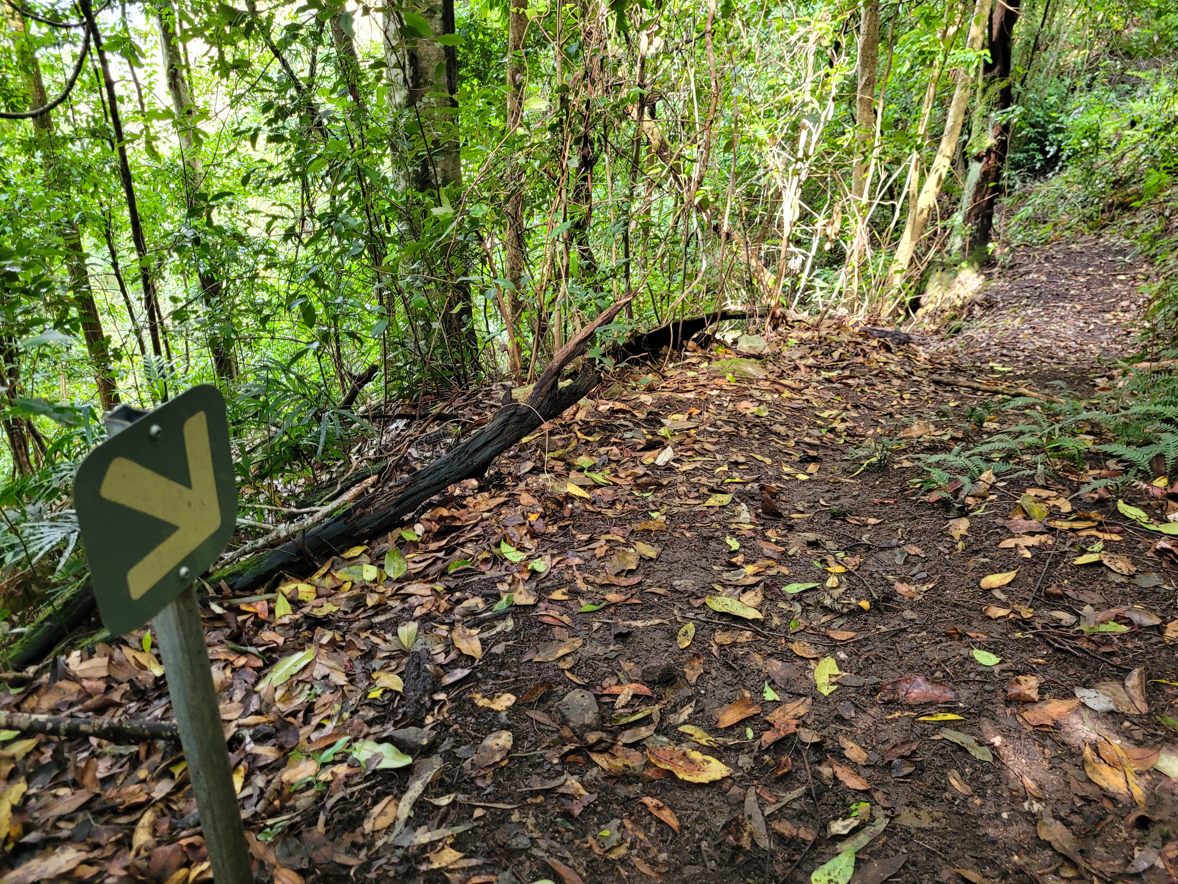
Shortly after following this path, it opened up onto a road leading both directions with no signage. As I looked down each path, I heard a noise and could see in the bushes across from me a few Kangaroos pretty well hidden (I attempted to photograph them, but they were very well hidden and if I zoomed in so much the photos were too blurry)
 |
| I don't know where to go |
I decided to go back to the carpark and continue walking down the main road to see if the track was down that way, walking past I decided to have a second gander at the large map. As I was approaching it, the man from the elder couple I mentioned earlier approached me to ask about Fairy Bower Falls. He was looking for it too. I told him I was also looking for it. We began looking at the map when another elder couple arrived (who I believe were locals, though sounded as if they had a slight German accent) they told us that as you come to the road that I had walked to earlier you simply follow that down to your right and you would come to the entrance of the walk. We all began to head there awkwardly together. As we reached the path, they let me go ahead and walked behind me eventually falling back (whether to keep a bit of distance or just walking at a much slower pace).
I enjoyed the scenery, the quietness and sounds and beauty around me. While I could hear the couple conversing behind me, they were a respectful level (not like some of the more obnoxiously loud people you can come across while walking). I soon reached the start of the walk.
I read the little blurb about Fairy Bower Falls, saying you could create a loop via Nicholas Pass. While I sat working out the map the other couple caught up with me and began looking at it as well, trying to work out where to go as there was the loop and different tracks to take. Soon the other couple (the ones with the maybe-German accents) turned up, and it became a while discussion about how the track to Amphitheatre was closed. I eventually just walked off without saying anything, wanting to get ahead and just deciding I'd figure out which paths to take once I got to them.
I continued along the path conscious of leeches due to the wet weather.

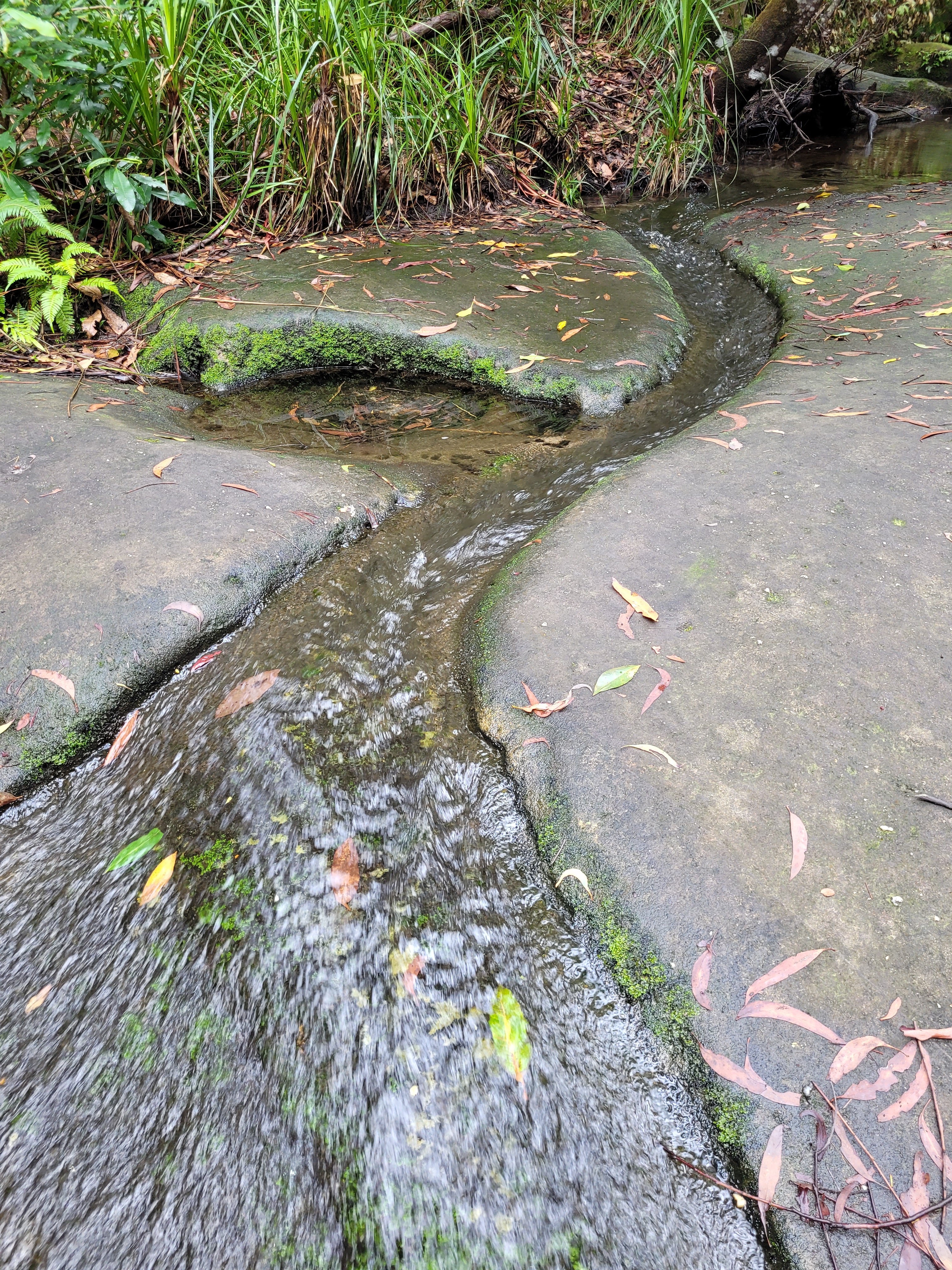
Passing my the rock slab on my right the path began to turn left and wind downwards. I could hear the running of a little stream and a Kookaburra began laughing from a nearby tree.
 |
| Looking back up towards the start of the trail |
As the path continued winding downwards, I saw a growth on one of the trees holding out some stones, I thought for a moment that they might be NSW Rocks. As I got closer I realised they weren't, but thought that they would not be there naturally. I remembered all the NSW Rocks I had found over the years that were still sitting on my bookshelf at home, that I had been saying for years I would 're-hide' whilst ever out on a bush walk, but had so far yet to do so. I lamented the fact that I hadn't brought one, thinking that would be the perfect destination to have placed it.
I soon came to a signpost pointing down the path the Fairy Bower Falls, but to the right of it, a path up hill, an alternate route back to the carpark that I noted I would take on my way back up.
As I rounded a bend I came across a small line of manmade trail, which must have been added for a reason I couldn't understand. Once I stepped onto it I did a quick look down at my legs for leeches before continuing on.
 |
| Couldn't resist a photo of some Shelf Fungi |
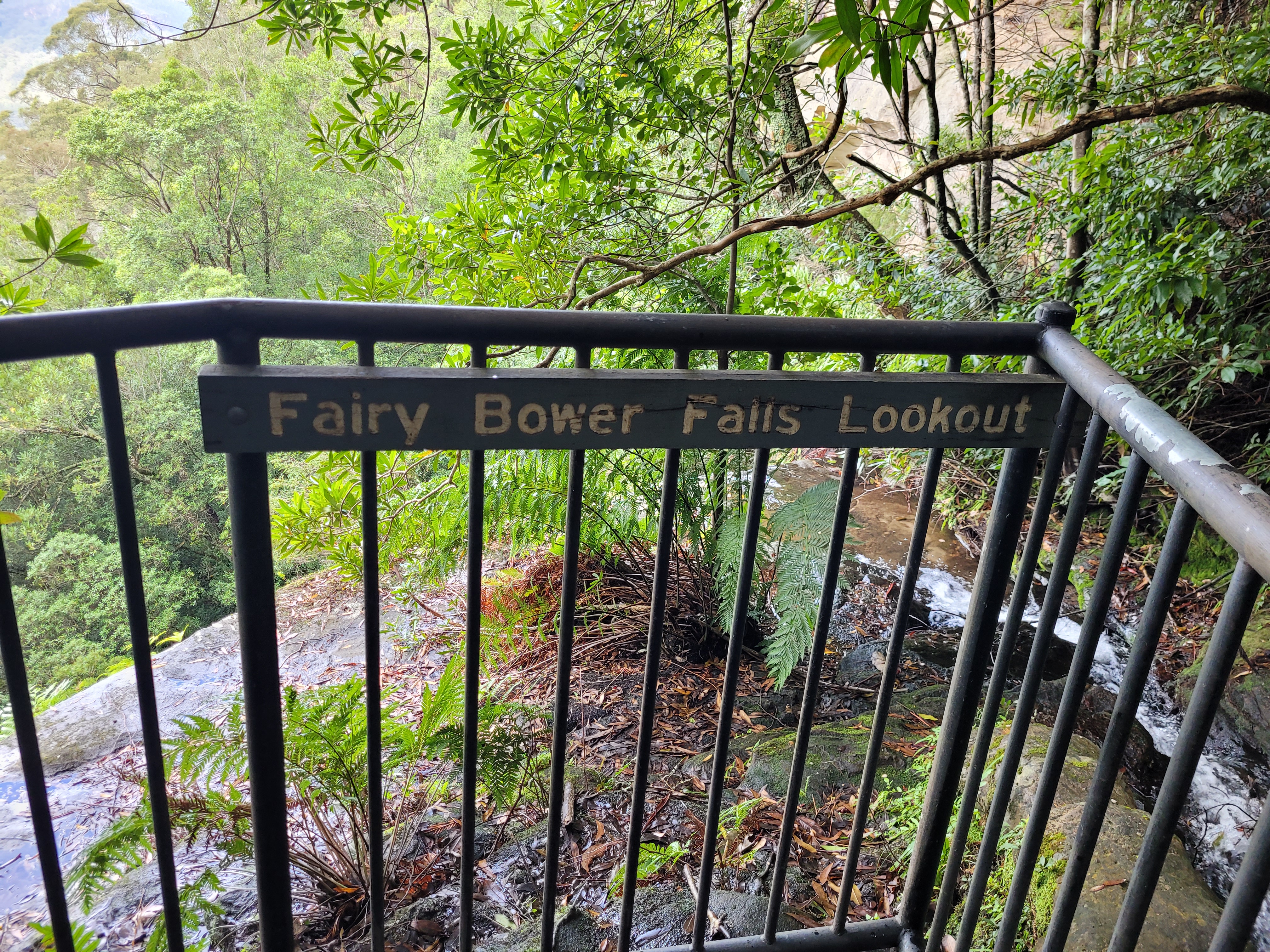
I could now hear the running water a lot clearer and as I rounded the bend the waterway opened up in front of me.
I noticed that Nicholas Pass was blacked out, harkening back to what the couple had said at the top of the walk about it being closed. I headed down to the path to the lookout.
I couldn't see the base of the falls as it was fenced in (and I'm not really one for jumping fences,
Belmore Falls not included). I began to walk back up so head down the path to the base of the falls, as I approached the top of the steps, I noticed something carved into the rock that I hadn't noticed on my way down to the lookout.
I wondered what the significance of the writing was. Was it originally called 'The Brides Lookout'? Had someone written that there later in an attempt to name it? Or was it actually called 'The Brides Lookout' and the new signage simply forgot to include its name? Why was it called the Bride Lookout? Obviously, I'd never learn the answer to these on my walk and the most information I could find about the potential naming is that brides honeymooning in Bundanoon back in the day would get photographed here. (Maybe there is more information in the town of Bundanoon about it, or in a museum but that was the most I could find with a quick Google search).
As I made my way to the turn to the base of the falls I encountered the elder couple again, the man mentioned to me about Nicholas Pass being closed pointing to how it was blacked out on the sign. I said I would just 'go and look anyway' and mentioned he was just near the lookout. I began walking up the path which took me to a more open and better view of the valley than the lookout had offered on another manmade walkway.
As I rounded the bend on the walkway there was a large rockface just ahead with brilliant orange colouring that really stood out amongst all the green I had so far been surrounded by.
After walking around the side of the rock wall the path began to continue down once more, leading to a seat for people to seat and have a rest (I assume after walking back up) and there was a little boulder to the right I couldn't help but climb on top of, hoping to get a better view of the valley (which unfortunately it didn't actually offer, with tree branches blocking the way).
I continued following the track down for a short while before coming across the fork in the path showing that the closed path along Nicholas Pass Track went on for 1.1km to Ampitheatre carpark (whether or not the Ampitheatre or Nicholas Pass continued on further as a walk from there I don't know but I might go back one day to find out.
Instead I continued on down the trail towards the base of the falls, passing numerous signs warning of unstable cliff overhangs above and asking not to linger in the area.
As I approached the falls you could see the visual difference in the greenery around you. The shades were darker, and much richer so that the photos of them made them look like I'd turned the saturation filter on in comparison to how all the plants had looked so far, along the walk.
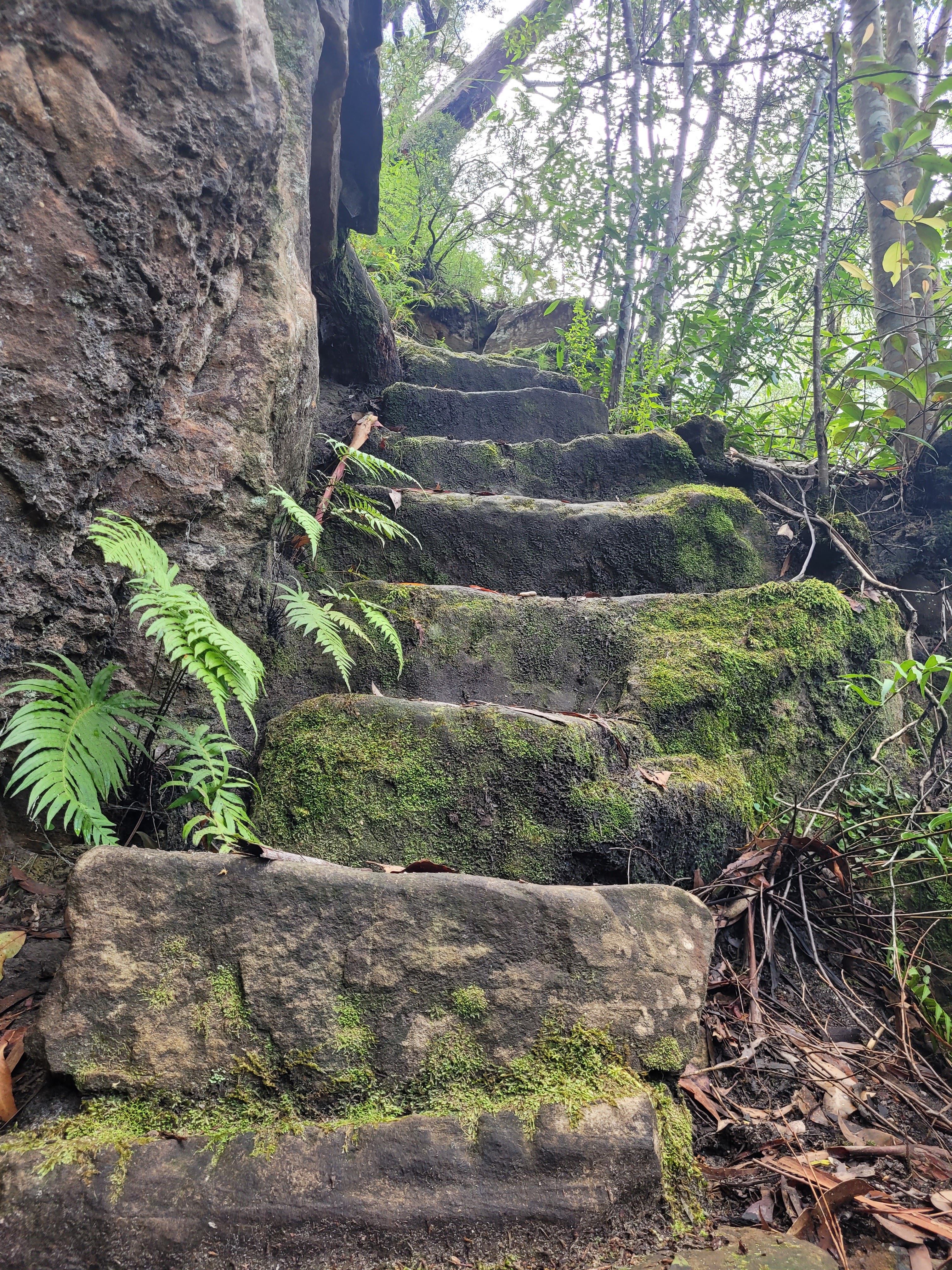
I noticed just prior to reaching the falls where water still steadily dripped down the side of the cliff walls an old stairwell leading to a gate that was sealed off, maybe from back in the day, but brought to my mind images and thoughts of 'The Lost World: Jurassic Park' that I was obsessed with as a kid, imagining the abandoned, overgrown, Dinosaur infested island.
I headed down more stairs, past another cliff overhang warning sign, and down another manmade walkway before getting my first look at the falls.
I squatted down on top of a boulder watching the water crash down, completely alone and in nature. I enjoyed the silence and the ambience of my surroundings before being startled by a couple who approached the falls from the opposite way that I had come, they startled me so much I lost my balance and slid a bit down the boulder I had been squatting on. I managed to get my balance so that when I slid onto the ground I stood straight up and didn't fall over. I nodded a hello, before going to retrieve my backpack which I had left closer to the base of the falls, deciding it was time for me to have a drink of water.
As I opened my backpack I found it was empty, realising that I had, whilst distracted discussing the garden with my Wife, completely forgotten to pack water. It was around lunch time now and all I had had was a coffee and 2 hash browns so I could feel how thirsty I was. But thought that I would find a tap in Bundanoon so it wouldn't be a big deal.
I wondered if the walk this new couple had come from was the loop track mentioned on the sign at the start of the walk, or if this was not yet the base of the falls, but just one of them, and if there was maybe another further down. So I set off down the path that they had come up from.
As the canopy above me opened up, the bush on each side of the path closed in, and I was soon dripping wet as the damp branches brushed along the sides of me. The path was on a slight angle and the mud was so wet that every step I took I could feel the mud beneath my feet sliding downhill so had to tread carefully to keep my footing.
I reached another split in the path. Right, heading uphill, to 'Tooths Lookout' and left downwards to 'Bundanoon Creek'.
I tried a quick search online to try to find out how far each was but was unable to get any reception. I looked back through the photos I had taken. Unfortunately, the picture on the map didn't say how far from here it was to Bundanoon Creek but showed that I could follow the track to Tooths Lookout and return to my car from there. However if I had looked at the very first sign at the carpark that had the list of all the walks and information instead of the map (which I didn't even think about) I would have learned it was a 3 hour walk from the carpark, and a 3 km return to Fairy Bower Falls (so I probably could have done it, or definitely could have if I had actually packed water). Instead, I decided I had better head up to Tooths Lookout if I was going to have time to also do Glow Worm Glen in the same day.
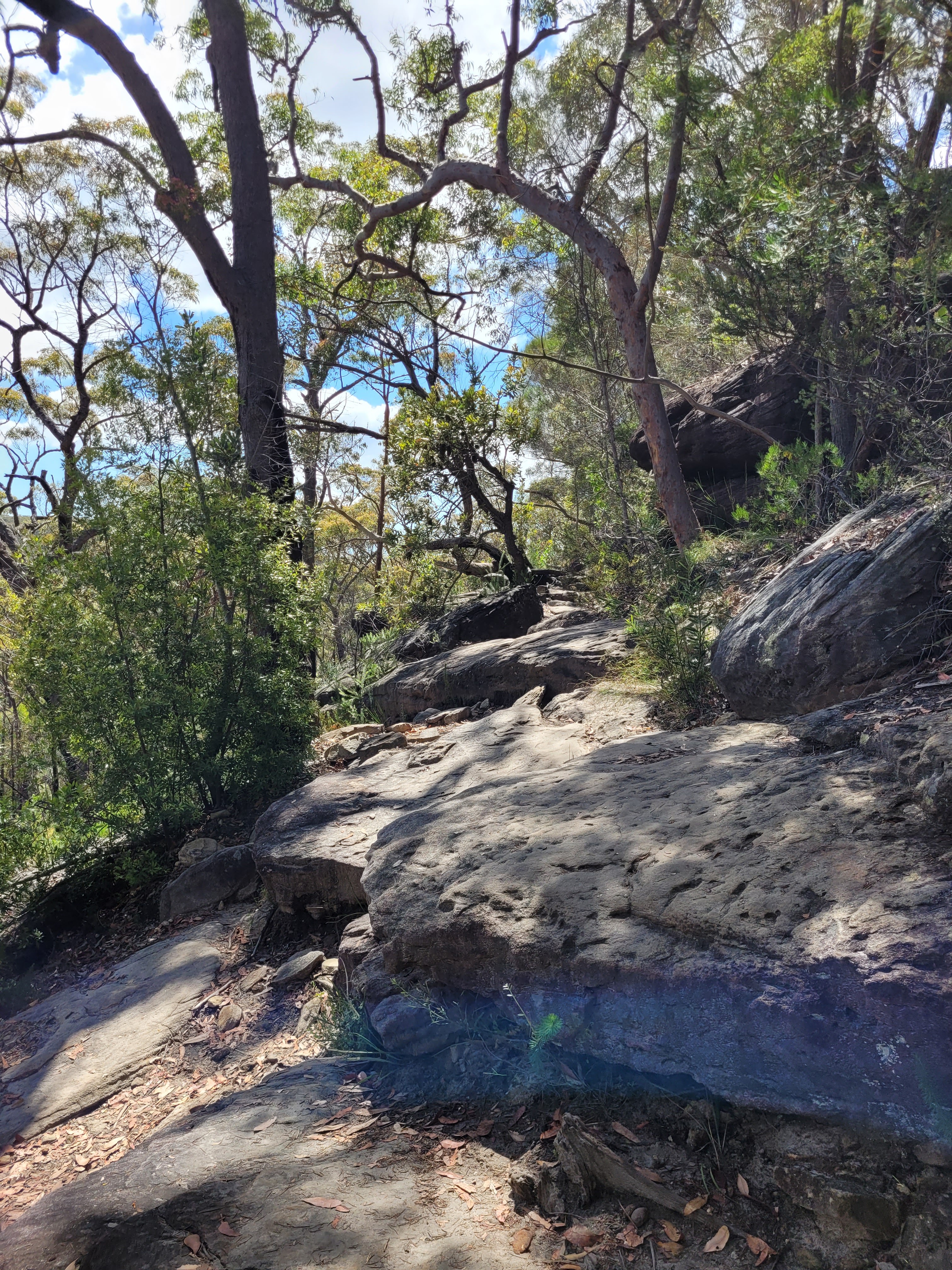
The track was definitely less walked, as I passed through a few spiderwebs.
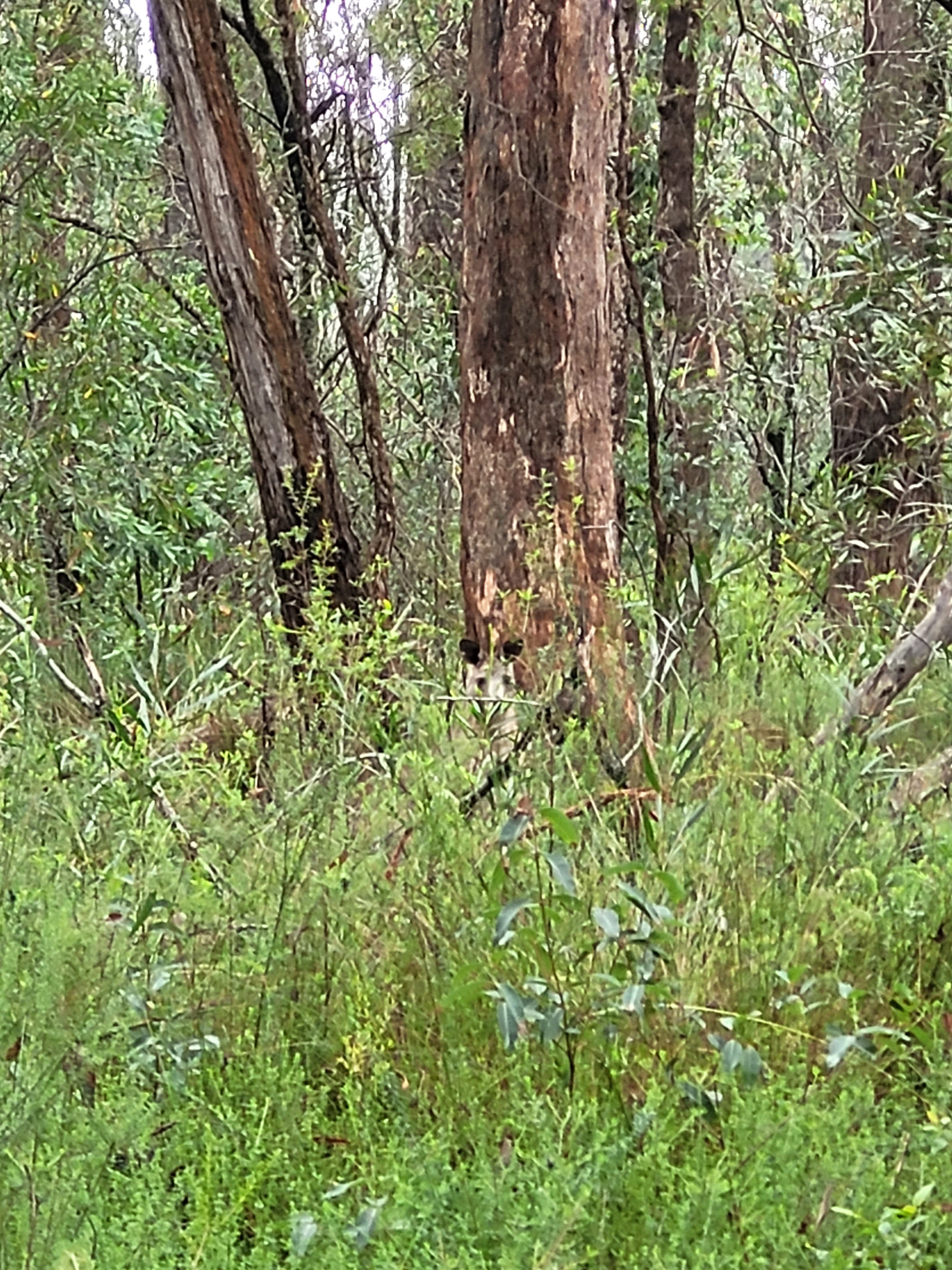
 |
| Phone camera did not want to focus on him |
I began to struggle to breath as I ploughed on uphill. I wondered whether it was the still the damage to my lung from the chemotherapy, or the lack of water, or both. (Or potentially the low testosterone, as I latter researched causes extreme fatigue and decreased energy as well as memory issues and trouble sleeping, all of which I had been having lately). I stopped for a breath even though I had been trying to mosey onward. This stop was short lived as I noticed I was beginning to attract the leeches.
I flicked him off and I kept pushing myself uphill, taking deep breaths, and forcing my legs to keep walking up the stone stair wells that occasionally appeared along the track, getting more frequent as I got closer to the top.
I finally got top a resting spot with a boulder I could sit on to avoid the leeches that offered a view of the valley. I rested here for a while, as messages from my Wife started coming through on my phone indicating I was now in location with reception. As I sat in the sun with a nice Autumn breeze blowing over me and cooling me down, I began to hear voices at the base of the walk indicating it was time to me to make my last push towards the top of the hill.
I pushed myself and finally made the top wondering if it would have been so exhausting if I had simply returned up from Fairy Bower Falls. At the carpark at the top there was a sign telling me that Bundanoon Creek was simply a 1.9km walk from where I was, but there was no way I was walking back down having just come up. Not without water.
I stopped to take in the views of Tooths Lookout before beginning along the track ahead of me that had numerous ringed Xenica Butterflies flying around.
I came upon a sign with information about the Bundanoon Creek Track warning the walk was not for the faint hearted, that made me and my very dry mouth not feel so bad.
I continued walking down the roads making my way back to the carpark. Coming to an intersection of road heading right to the Fairy Bower Falls walk and left to the picnic area. I figured I had already walked along the Fairy Bower road so continued up the road back to the picnic area.

The day was now super sunny compared to the dense mist I had encountered when first reaching the top of Macquarie Pass. As I continued the path in the sun, feeling my wet clothes dry while on my body an old man on a bike road past and I waved. Soon the road turned completely left and I began walking the long way down it, far away from where the Fairy Bower Falls road had been and I began questioning if it was taking me to the right area. As I approached the picnic area I was unsure it was the right spot, cutting through the bush to the field, I realised it was, as I noticed my car on the opposite side, and that I was walking up the road that Google Maps had asked me to go down with the sign telling me not to.
I crossed the Wombat poo laced picnic area and returned to my car, looking at the time and realising I still had to find water, and that I had planned to drive to Mittagong to Eden Brewery (that Tristan and I went to after each attempt at Mount Jellore) to get their Black Clover Irish Stout that they had released for St Patrick's Day the week before, I knew I did not have time to do the Glow Worm Glen walk, deciding I would head in to Bundanoon to find water before going to get my stout.
However while looking at the Bundanoon Creek Track signpost I had seen a Grand Canyon and Sunrise Point lookout that I decided to jump into my car for a quick drive down to see. "I was up here anyway" I thought.
As I followed the road down I came to another two way section, heading right to Grand Canyon Lookout which I followed, pulling up and getting my first look at the 'Australian Grand Canyon'.
As I took in the view my stomach rumbled with hunger and I could feel how dehydrated I was. However there was another sign here with a walk to Gambells Lookout and 'Fern Glen Walk', neither particularly long, so I quickly walked down to Gambells Lookout.
Before walking down the Fern Glen walk.
 |
| One path led to this fallen tree but as I went to walk under it, there was just a stream and no path |
As I wandered a few different paths I couldn't actually find which was the proper trail meant to lead anywhere, they all seemed overgrown and there didn't seem to be a clear path. "I don't have time for this" I thought, looking at the time on my phone and also seeing my phone battery had somehow drained exponentially, leaving me worried it would go flat before I could use it to get to the brewery. I quickly headed back uphill jumped in the car, and began driving to Sunrise Point.
I arrived at Sunrise Point, another lookout over the same valley, and wondered if there was any walk down to the 'Grand Canyon'.
I set Google Maps to the brewery, and began my drive there, deciding to bypass stopping anywhere in Bundanoon for water or food.
Finally after a 30 minute drive I arrived. Walking in, sweaty, smelly, hungry and dehydrated.
I asked if they had the Black Clover Irish Stout bottled (as my plan was to take it home). They didn't but they had refillable containers of 1 litre or 2 litres. I asked how much they were (too much for what I wanted to pay). I asked about a schooner, which was $9. So I sat down and drank my Stout whilst dehydrated and hungry and having to drive an hour home.
I sent a picture of the stout to Tristan telling him I was yet to eat or drink, saying I would just stop at Robertson on the way home for a pie. I devoured the stout because I was beyond thirsty and it was super delicious. I hopped in the car and began the drive home with my stomach rumbling.
Soon I pulled up outside of Southern Rise Bakery, only now seeing Tristan's reply telling me to go to 'Gumnut Patisserie'.
I told him Gumnut gets packed (with good reason obviously), before sending him a photo of Southern Rise showing I was already there.
"Keep driving they suck." He responded. "They're bad quality and unimaginative. Robo at least has the volcano pie."
I told him there was no where else but the Robertson Pie ship, which in my opinion sucked. "A pies a pie." I responded to him.
"Wrong, so bloody wrong." He messaged back.
I decided to take a screenshot of my blog post 'Belmore Falls' which was written back in February 2020. In it, he listed his top 5 bakeries in the Southern Highlands with Southern Rise being his 4th. I told him "Don't rewrite history."
He responded that since covid they had "gone downhill fast" and said that 3 from that list had since closed and that "Samuel Gee in Willow Vale is now top tier".
My phone went flat and I went inside anyway and asked for a chilli pie, which they were out of. I looked at the list and asked for a Mexican Pie, which they had. I got into my car with it devouring it. "Not even bad." I thought, licking my lips, though it wasn't really Mexican flavours, more a spicy tomato. I turned on my car and continued down the pass, getting home just before nightfall, realising I had no hope of doing Glow Worm Glen that same day, but giving me a reason to return to the Highlands (along with heading down to Bundanoon Creek). I hopped in the shower to wash off, where I did the most dehydrating wee off all time, after cleaning off I made sure to quench my thirst by drinking all 3 of the water bottles I had left in the fridge.
Thanks for reading! - Steven


.jpg)