This walk takes place on Dharawal Country
While doom scrolling my Facebook newsfeed like a mindless zombie on the weekend, a post from an indigenous street food truck that I follow (Mirritya Mundya) appeared on my feed, promoting their 'Emu and Lamb Guiness Pie'.
'Oooohhh.' I thought, always a lover of trying different foods.
The truck was based down in Bomaderry, where I had just been for walks on both the two prior weekends, but it had been closed on those occasions.
I had the following two days after the weekend scheduled off from work and debated heading down to get one of the pies.
'It's a long way to go for just a pie.' I debated to myself, deciding to have a look for any nearby walks, hopefully just a short one, that I could do to make the drive south for a pie worth it.
As I investigated, I found a walk called 'Red Rock Trig Trail', an apparently easy 1.9km walk, and decided that is what I would do.
You might be wondering why I just wanted a short walk, well that was because I had just written another decently long blog post and felt writing fatigue so didn't want to have to write another huge blog.
"Well Steven, do you have to write about every new walks you do?" You might ask.
Well dear reader, sadly blogging is the only feeling of satisfaction, fulfillment and feeling of accomplishment, like I've actually done something with my life, which I lack career-wise, so yes, yes, I do need to write this up, lest I feel worthless and sad.
Anyway, I digress.
Monday came along and I woke up in the morning, pruned my mandarin and lime tree then sat inside drinking copious amounts of coffee while catching up on episodes of 'The House of the Dragon', debating whether or not to go for the drive down while my gorgeous Dog sat snuggled in beside me giving me the 'don't leave me Dad' eyes.
However, my Wife messaged saying she was going to come home from work as she was feeling sick, so I waited until she arrived home so poor little Orla (my Dog), was not left alone.
When she got home, I packed my water bottle, and began the drive south while listening to the indigenous artist 'Allara' to set the mood.
When I finally arrived at Mirritya Mundya on Concorde Way, I hopped out of the car, strolled right up and requested the emu, lamb and guinness pie.
The guys looked at me hesitantly and turned to the man behind him to ask about them, that man turned around and said.
"Oh, we don't have them in, they're coming later this week."
I felt my heart sink. It was a long way to drive for a pie, especially when the pie is not there.
He commented saying that they had a brisket and mac pie, and too awkward to walk away without purchasing anything I said, "I'll just get that then."
Walking away with a pie I didn't necessarily feel like due to my own social awkwardness.
I set Google Maps to the walk and ate the pie while I drove. It was packed densely with the brisket meat, and didn't really have any gravy, it was truly a 'meat pie'.
As the drive took me around the back streets of Bomaderry, Google Maps played up and would swap every 5 seconds between telling me to head the way I was heading, with a right turn at the end, and swapping to turning me to turn around and go back the way I had come from, stressing my out because it would swap and change to rapidly.
I eventually followed the street to the end, and turned right pulling up as Google Maps settled and finally just took me in the direction I was going, towards Red Rock Trig Trail.
I headed out from Bomaderry, towards Badagarang, where I then got held up in roadworks. As I sat in the roadworks for about 10-minutes I felt like nothing was going right. Finally, we were allowed to proceed, and I began heading up the winding mountain pass that reminded me of a mix between Macquarie Pass and Jamberoo Pass.
Halfway up here we were once more stopped with roadwork, causing me to loudly groan and sigh. This time it felt like I was stuck for even longer as one car came past from the other direction. It felt like another 10-minutes until finally a series of cars came through and we were allowed to continue up the mountain now. As I drove up, I noticed the left side of me having repairs works down, obviously erosion had given way and mud or trees and rock and fallen over the road, probably due to all the heavy rain, wind and extreme weather events we'd had lately. On the right side I noticed some of the road heading down the mountain had completely given way and collapsed over the edge.
"Shit." I said, looking out my window as I continued uphill.
As I came to a bend in the road, where my GPS was telling me to turn left, this bend was filled with the road workers and the turn off up that road was blocked off.
"Shit!" I said to myself, continuing around the bend has the road now began winding down the mountain.
I had no idea where I was, and had never been in the area before, so all I could do was continue the drive down the mountain waiting for a spot where I could pull over which took between 10 and 20 minutes.
I finally pulled up, surrounded by farmland, wondering if I should just give up and go home. However, I remembered another walk I had looked at when trying to decide to go for a walk.
'Bundewallah Reserve'.
I decided to GPS to there so my entire day hadn't been a waste. The directions told me I could continue forward the way I was going and turn right at Kangaroo Valley Road, or I could go back the way I had come which it said was '4 minutes shorter'.
'Yeah, not with all the road works.' I thought and continued driving along past the farmland eventually turning right at Kangaroo Valley Road.
This was a long, winding road and was slow going, with my GPS saying it was going to take me just under an hour to get to that walk. I drove past all sorts of estates and retreats, before coming to a section of Kangaroo Valley Road which was closed and having to turn right down Tourist Road (later looking at maps of the road, I saw if that had not been closed my trip would have been much shorter).
This road continued on past all sorts of hidden retreats and I wondered if they were just getaway spots, or if they were those weird silent retreat places people go in films and tv where you give away your phones and connections and things.
As I was heading down a section, I saw a turn off on my left to Cambewarra Mountain lookout, however there was a car heading up the mountain with their indicator on to turn there, and as I only saw it last minute, I continued past down the mountain, when they turned up that way.
I slowed down in my car thinking. I thought I should see the lookout but had already driven past, 'but then, when was the next time I would be around this area?', I thought, bringing my car to a halt on the empty road and reversing back up the hill to turn off towards Cambewarra Mountain lookout.
I pulled up, in the parking area, discovering some sort of restaurant or cafe was here too. As I hopped out of my car the other car that had just gotten there had arrived with two young people hopping out and as I looked, I witnessed the young male squeezing his female partner's butt.
'Ok then.' I said silently to myself, raising an eyebrow and walking off on my own to take in the view.


I stood on my own, atop the mountain, gazing out at the other mountain in the distance, I wondered what it was (I believe it is Coolangatta Mountain), my eyes followed the Shoalhaven River out to Shoalhaven Heads, and I could spot Comerong Island, where I had gone on a day trip adventure with my Dad and added the details of underneath my blogpost 'Barren Grounds - Kangaroo Ridge and Griffiths Loop Track', which in retrospect I should have just done as it' own short little blog post, rather than hidden away on some unrelated blog.
I stood trying to take a panorama shot with my phone and ended up fumbling and dropping my phone, causing a crack in my phone screen. My face twitched and I felt my teeth grit as I tried to hold in the frustrations of my day. I walked back to my car, continuing on route to Bundewallah, and started screaming once I was back on the lonely mountain road.
"Fuck!" I screamed. "FUCK!" At the top of my lungs, pure psychopathic rage, had anyone seen or heard me they would have thought I was insane.
You may think this is a bit of an overreaction, given the day I was having. But this wasn't just about the day. It wasn't about the pie, or the traffic, or the closed walk, or my phone screen. These were today's issues. But this was a build-up. Pent up frustration, anger, anxiety and resentment.
This was years in the making. From the covid lockdowns, to my fractured ankle, to my cancer diagnosis and treatment (all during the pandemic), to returning back to work, which had progressively gotten worse, with no career progression only more work and responsibility with no more pay, with a cost-of-living crisis and issues with my own home life. I had just been thinking to myself lately, what exactly did I beat cancer for? To just be constantly kicked and knocked down? To just continually struggle with only the rare opportunity to travel and adventure. It was the build-up of all these frustrations that caused me to scream alone in my car like a maniac.
I continued the was Google Maps was taking me and I soon found myself in roadworks once more, for another 10 minutes, as I came down the mountain in pretty much the same location that I had gone up it.
"What the actual fuck." I said to myself, passing by another roadworks but not being stopped this time as I soon entered onto the main highway through Bomaderry, turning left to head north towards Berry.
"What a clusterfuck." I said to myself, looking at the time as it was almost 2pm.
I followed the Princes Highway, turning left towards Berry, but then taking a left turn away from it at the first roundabout, leading me to a second roundabout where I turned right up Kangaroo Valley Road. I followed this up for a short while before turning up Bundewallah Road, where I soon found my location, a very small and indiscreet area right next to someone's large and glamourous property.
I thought to myself 'I hope these people realise how lucky they are to live in a place like this."
I had pulled in as I arrived, but decided to reverse park instead, pulling out and reversing back in, as I hopped out of my car, reading the sign about it being a Shoalhaven Bushcare area.

I followed the steps down a short way, and it immediately led down to a creek.
 |
| Facing downstream towards someone's property |
 |
| Facing upstream |

 |
| Giant Stinging Tree Leaves 'Dendrocnide excelsa' |


'That could just be a GPS error.' In also thought, but decided to head back, keeping an eye on my left for any sight of the trail.

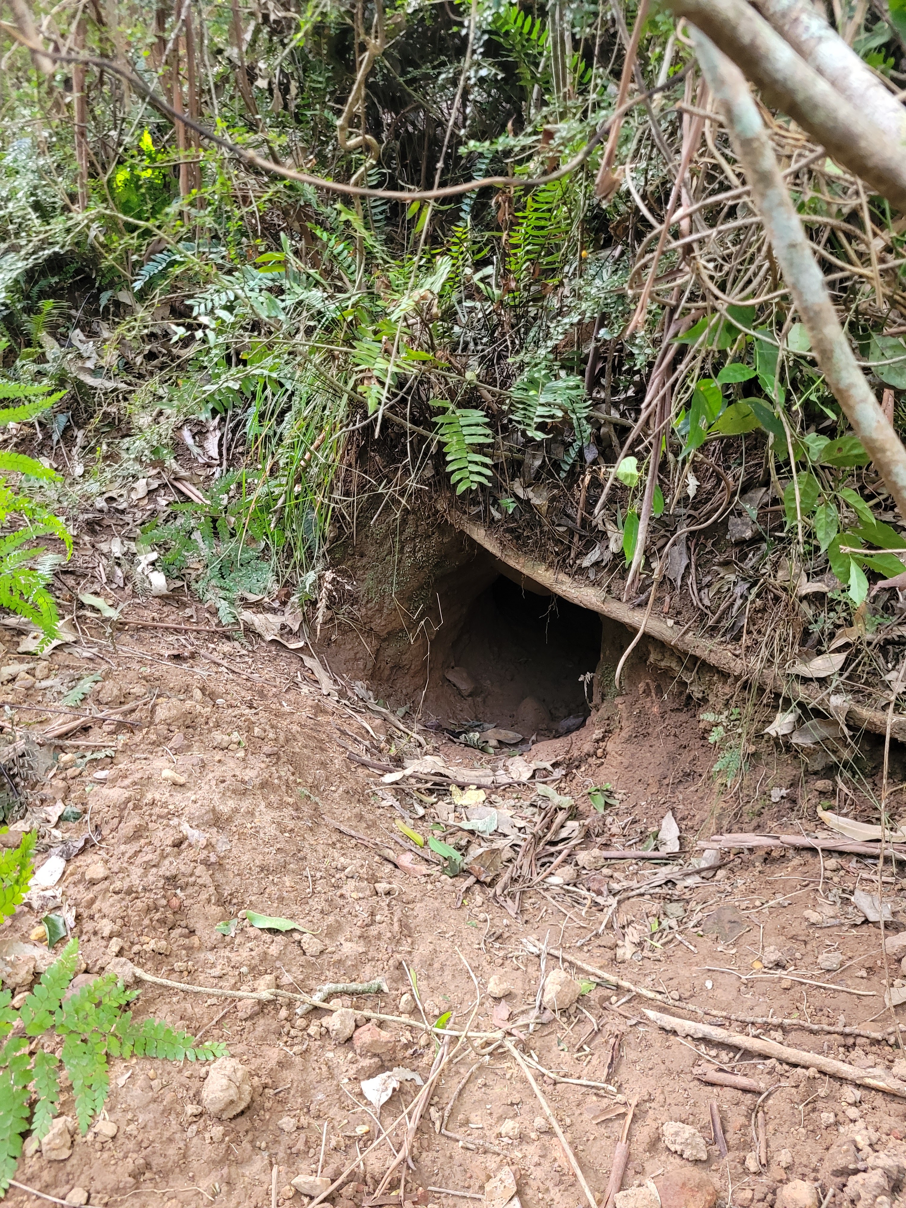 |
| A wombat track to a wombat hole |
 |
| Looking down it, the way I should have come up |
 |
| The trail upwards, feat. wombat poo |

As I reached the top of this section I stopped to guzzle some water, removing my jumped and shoving it into my backpack. I felt demoralised, lowering my mood further. It reminded me of how I had felt the first time I attempted 'Bong Bong Pass' again after my cancer treatment.
How had my fitness gotten so bad again, I thought, or was this still the effects of catching covid? I thought, thinking about how I had been doing huge hikes daily while in Iceland. I had my yearly cancer test and appointment coming up, so I thought I would see how that fared before I worried, maybe I need to just get a bit of fitness up.


I waited until the throbbing pain in my ears, subsided, and until my chest no longer felt on fire, as a cool and gentle breeze was blowing, cooling me down.
I listened to the sounds of whipbirds and all the other sounds of wild birds, while getting a whiff of myself and realising how badly I smelled.
I took another swig of water, before moving on.


 |
| And accidentally capturing the side of my finger too |
 |
| Looking back at the steps I had come down |


I don't know how long I was there for, just sitting, alone out in the bush. Usually when doing a walk, I feel a sense of joy, or achievement. A sense of purpose or adventure. Or at the very least and sense of spiritual connectedness with nature. But I wasn't feeling that on that day. Instead, I just felt lonely.
The very next day I took Orla out for a play at the park, it was a warm sunny day as she ran and fetched her ball, and I felt happy. I know I have to work to make improvements to my own life, for the sake of my health and mental health and hopefully other blogs can be more upbeat and optimistic in tone.